Project
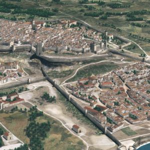
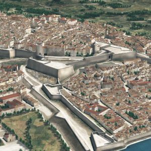
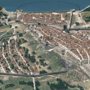
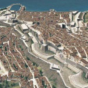
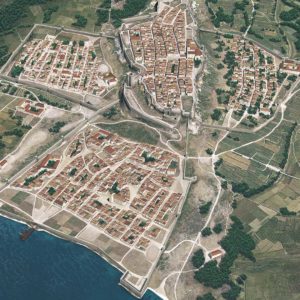
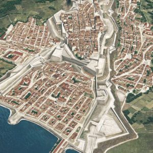
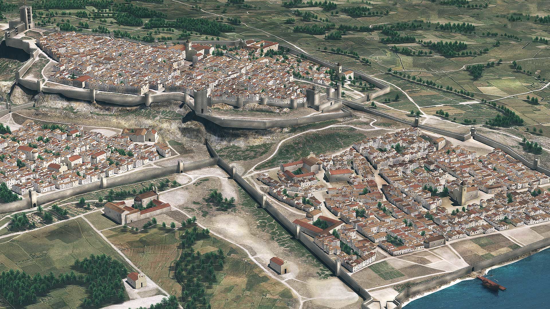
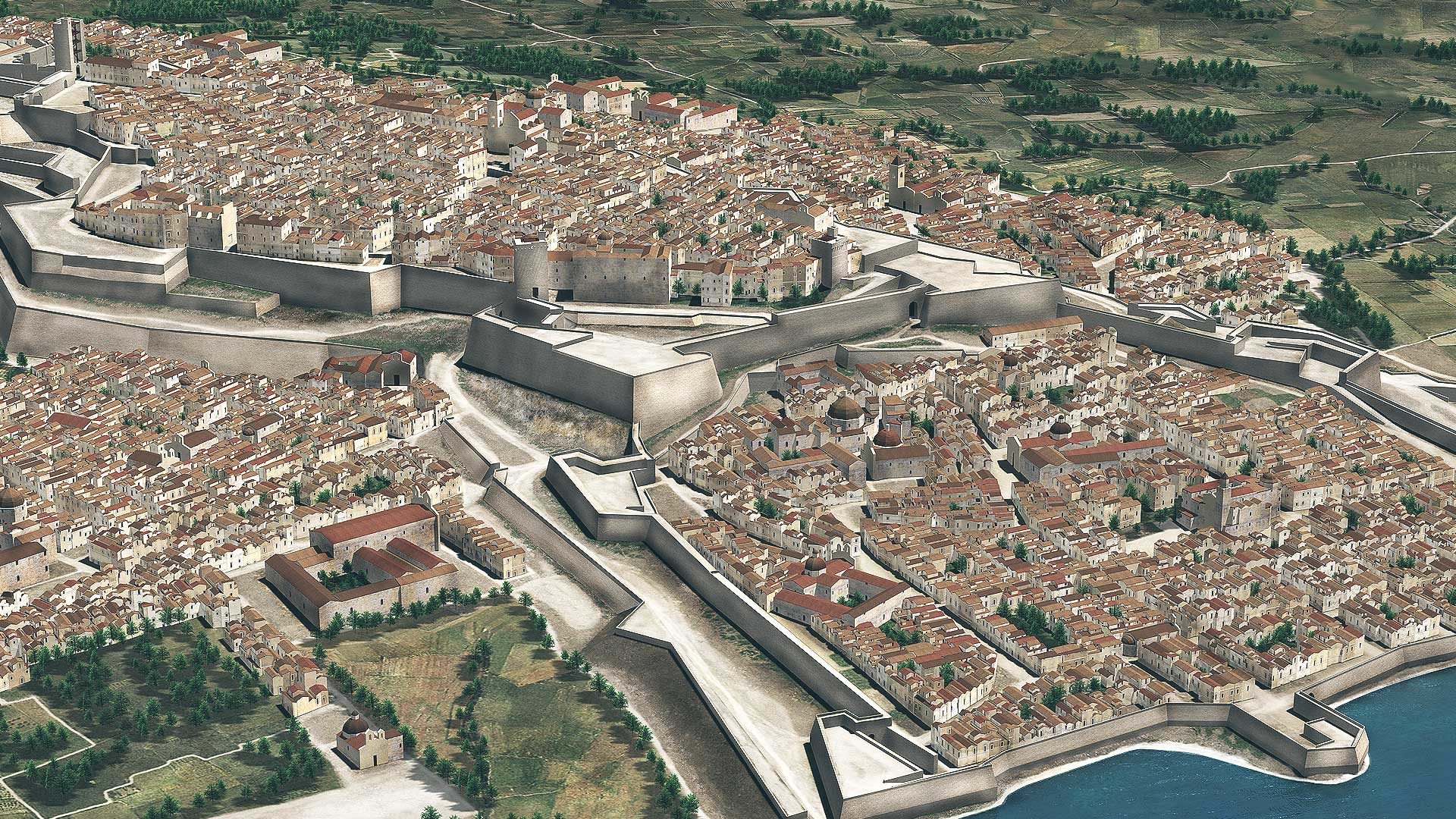
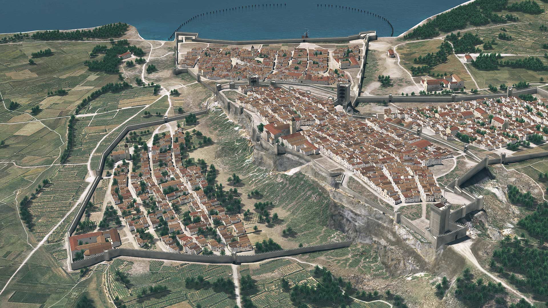
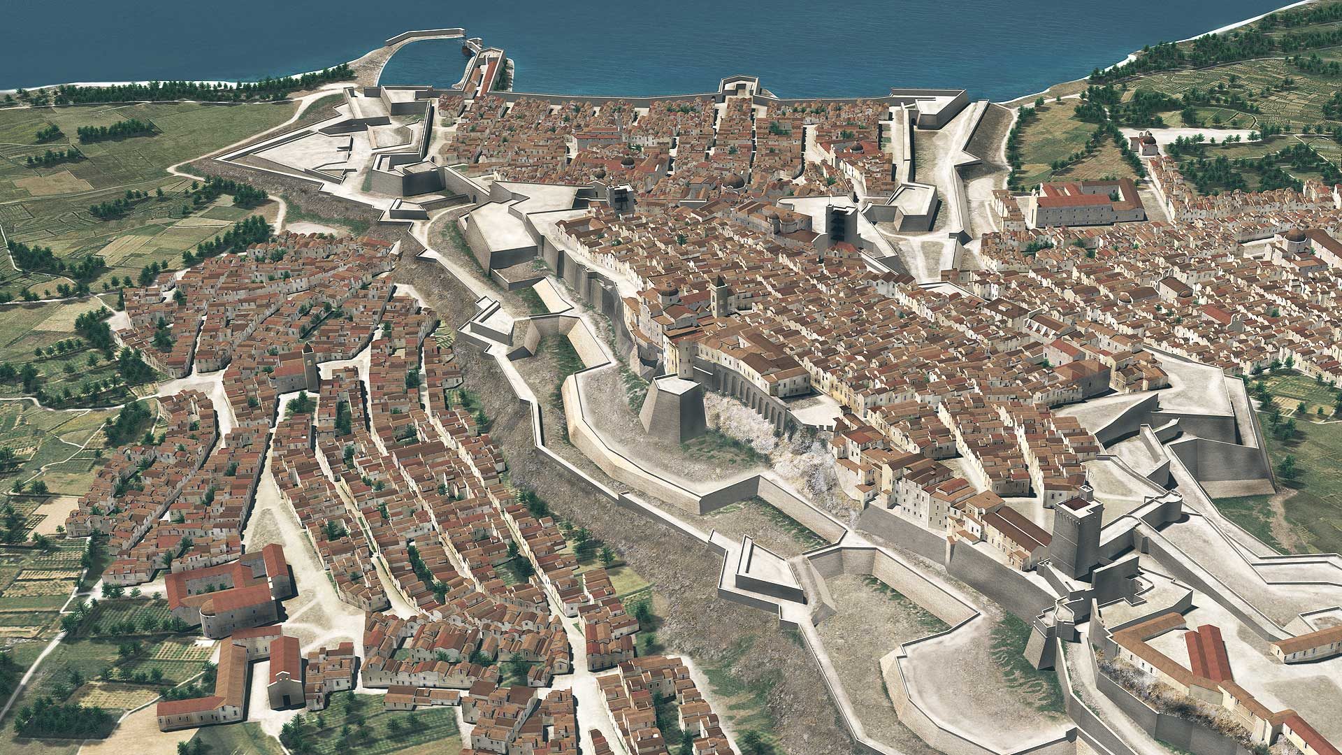
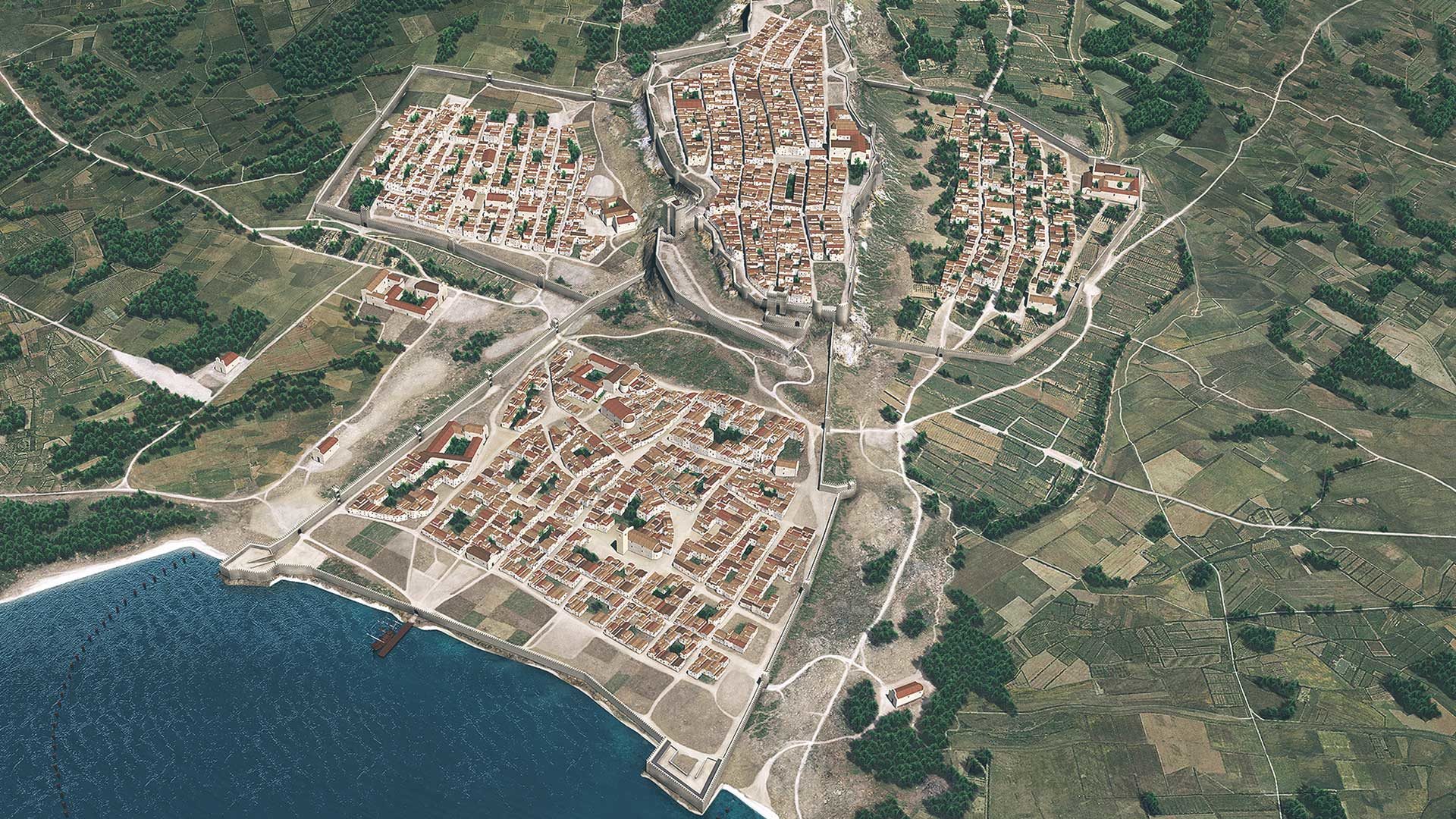
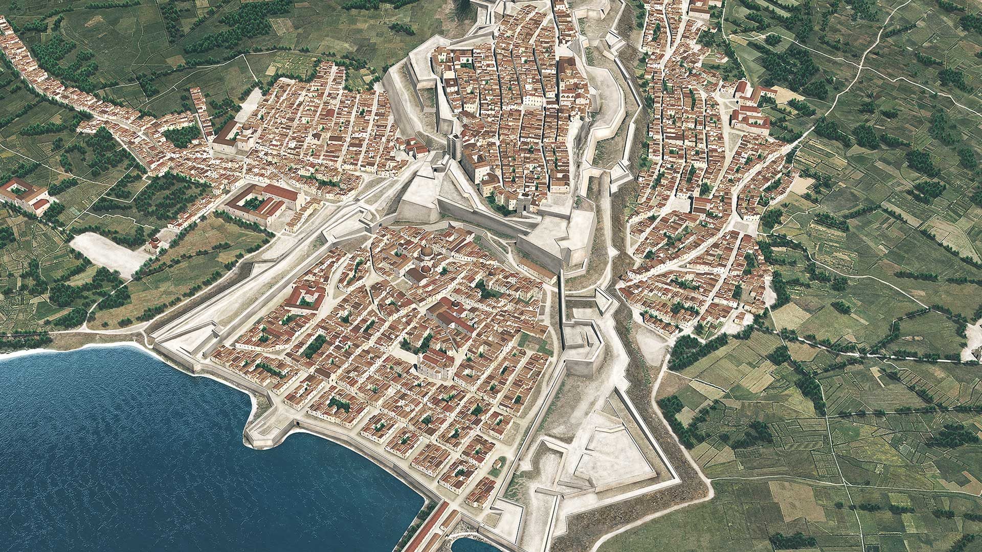
The project consists of the 3D historical reconstruction of the city of Cagliari with its wall fortifications in the XV, XVI and XVIII centuries.
The project consists of the 3D historical reconstruction of the city of Cagliari with its wall fortifications in the XV, XVI and XVIII centuries.
For the 3D historical reconstruction of the city of Cagliari we first considered the structure of the wall fortifications still visible in the present days. Though incorporated in buildings of recent centuries or partially dismantled, such fortifications show their impressive presence in several points of the town. Aerophotogrammetry at the 1:500 scale and on-the-spot investigations allowed us to obtain a reliable basis for the reconstruction hypotheses.
Further data have been obtained from historical cartography and several already published studies, as well as through the close cooperation with M. Beatrice Artizzu, architect with wide expertise in ancient cartography and fine connoisseur of the city of Cagliari.
The final reconstruction hypotheses show the city in the XV, XVI and XVIII century, respectively. The transformation undergone by medieval walls and towers in the XVIII century, as a consequence of the wide diffusion of fire-arms, is quite clearly rendered in the simulation, which also shows in details how the fabric of the city has changed over the centuries.